POS辅助空中三角测量在大比例尺航空摄影测量中的应用研究
2017-03-31 19:13:53刘爱霞吴文静
科技资讯
2016年33期
刘爱霞 吴文静
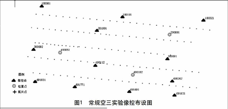
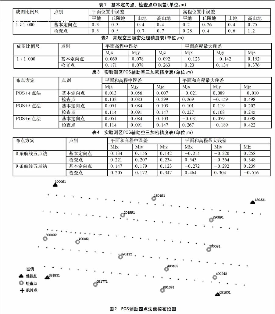
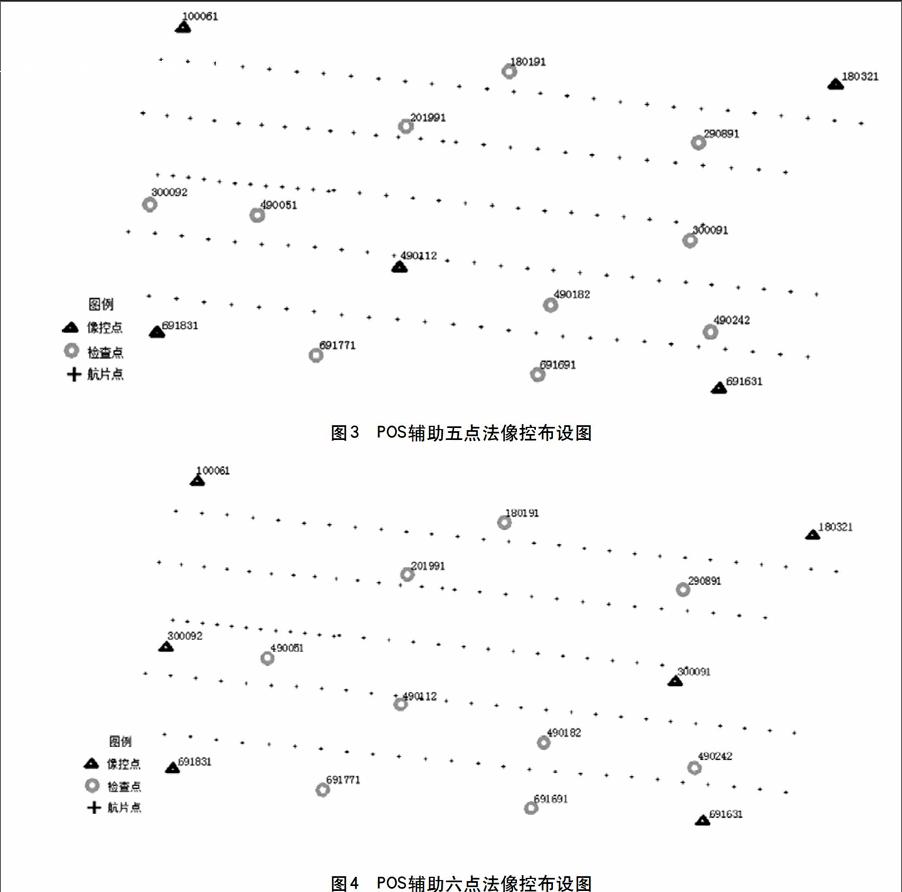
摘 要:POS辅助空三技术的应用使得传统航空摄影测量摆脱了对于大量地面控制点的依赖性,在提高作业效率的同时也带来了很大的经济效益。该文结合具体的生产项目,对1∶1 000大比例尺测图中POS辅助空三的精度进行分析,并通过实验探讨像控点布设的最优方案,为POS辅助空三在1∶1 000成图中的应用提供技术依据。
关键词:POS辅助空中三角测量 像控点布设 最优方案 精度分析
中图分类号:P23 文献标识码:A 文章编号:1672-3791(2015)11(c)-0009-04
Abstract:POS supported aerial triangulation technology application make the traditional photogrammetry from the dependent on large number of ground control points,this can not only improve the operational efficiency,at the same time also brought great economic benefits.This dissertation mainly make Accuracy analysis of POS supported aerial triangulation in 1∶1 000 large scale digital mapping,and discuss the optimal solution of the control point layout through experiments.All of those provide a reliable technical support for the POS supported aerial triangulation application in 1∶1 000 large scale digital mapping.
Key Words: POS supported aerial triangulation; Control point layout; Optimal decision; Accuracy analysis
近几年,将POS系统应用到航空摄影测量领域成为研究热点。POS系统主要由GPS和IMU两个核心部件组成,GPS 用于获取影像的空间坐标,IMU 用于记录三个姿态角,将POS系统与航摄仪集成在一起,通过联合解算可以直接获取到每张像片的6个外方位元素。
POS 辅助航空摄影测量方法主要包括:
(1)直接定向法(Direct Georeferencing,DG)[1],采用IMU/GPS辅助航空摄影技术,得到每张像片的外方位元素,实现无需地面控制点的航空摄影测量方法。
(2)辅助定向法(Integrated Sensor Orientation,ISO)[2],即将POS系统获取的每张像片的外方位元素作为带权观测值参与摄影测量区域网平差,进而得到每张像片的高精度外方位元素。
该文重点研究了POS辅助定向法满足1∶1 000成图精度的像控点布设方案,为项目的进一步执行提供技术参考。
1 POS辅助空中三角测量
1.1 POS辅助空中三角测量
POS辅助空中三角测量,国际上也称为ISO(Integrated Sensor Orientation),是将基于GPS/IMU 组合系统直接获取的每张像片的外方位元素,作为带权观测值参与摄影测量区域网平差,获得更高精度的像片外方位元素成果。……
登录APP查看全文