
广东北江流域降水集中度和集中期的时空变化特征
2017-07-29 18:45:40刘占明魏兴琥陈子燊江学顶
南水北调与水利科技
2017年4期
刘占明+魏兴琥+陈子燊+江学顶
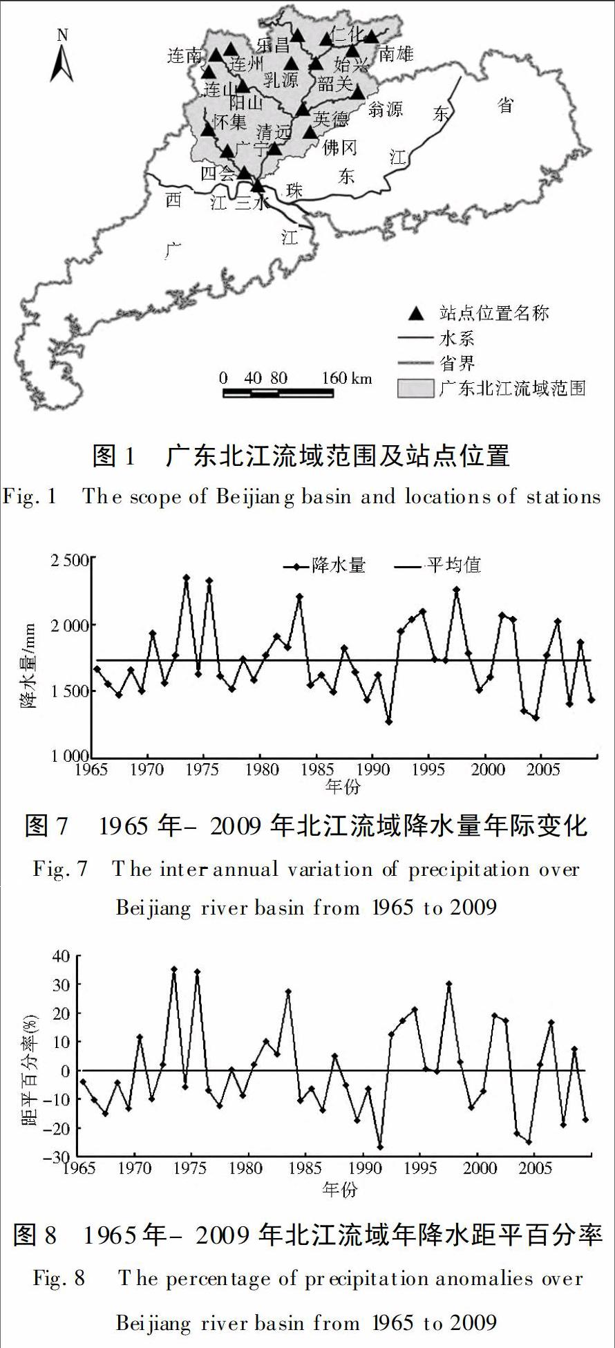
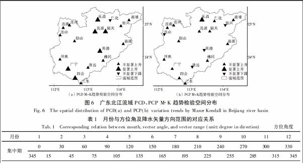
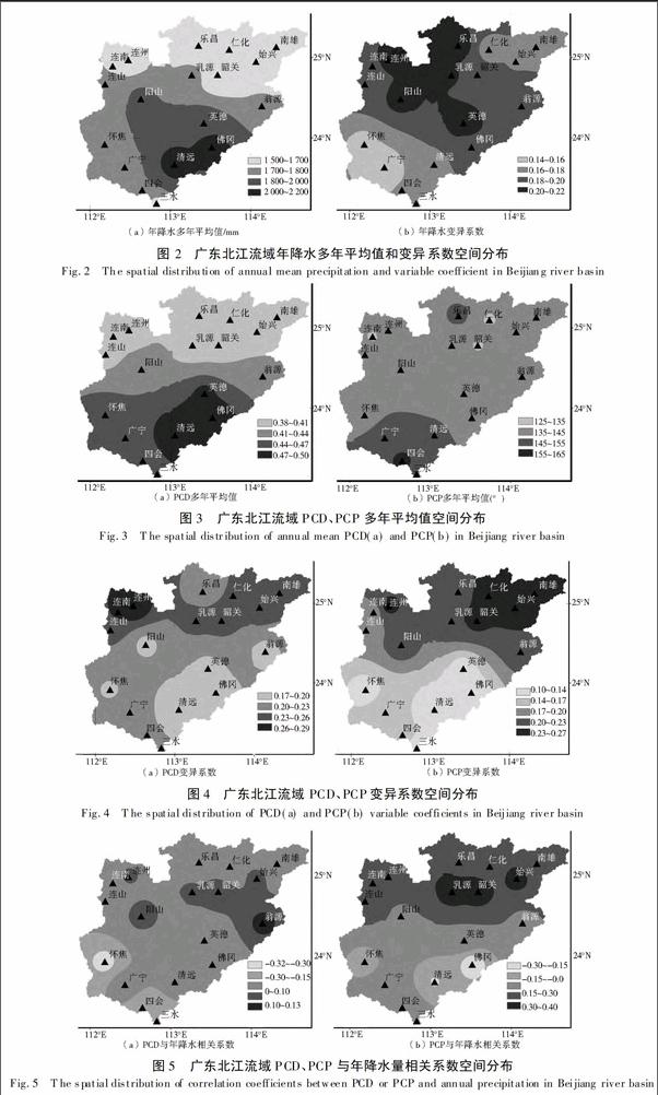
摘要:基于广东北江流域分布较均匀的18雨量站1965年-2009年日降水资料,统计出各站各年份降水集中度(PCD)和集中期(PCP)指标,然后基于该指标分析流域降水集中度和集中期多年均值、变化趋势、与年降水量相关性、丰水年枯水年合成分析的空间分布情况,以期研究流域降水年内非均匀分布的时空变化特征。结果表明:(1)降水集中度总体表现为从南向北递减;降水集中期主要表现为中北部的大部分区域较为提前,南部区域较为滞后。(2)大部分区域表现为年降水量随着降水集中度的下降而增加;南部区域年降水量随着降水集中期的滞后而减少,北部区域反之。(3)MK趋势检验表明,流域降水集中度、集中期均主要表现为上升,但不显著。(4)降水集中度空间分布上,丰水年与枯水年比较一致,但枯水年降水集中度更高;丰水年降水集中期差别较大,从流域平均来看,丰水年集中期较枯水年约滞后20天。
关键词:降水集中度;降水集中期;广东北江流域;反距离权重插值
中图分类号:P461 文献标识码:A 文章编号:1672-1683(2017)04-0019-07
Abstract:Based on the daily precipitation data between 1965 and 2009 from 18 rainfall stations in Guangdong Beijiang river basin and the definitions of Precipitation Concentration Degree (PCD)and Precipitation Concentration Period (PCP),this paper studied the intra-annual inhomogeneous distribution characteristics of the precipitation in the basin by analyzing the spatial distribution of the multi-year mean values,variation trend,correlation with annual precipitation,and wet-year and dry-year composite values of PCD and PCP.The results are as follows:(1)PCD generally decreased from south to north;PCP was earlier in most of the north-central basin,but relatively later in the southern basin.(2)Annual precipitation would increase as PCD decreased in most of the basin;as PCP delayed,annual precipitation in the southern basin would decrease but that in the northern basin would increase.(3)As the Mann-Kendall test showed,the PCD and PCP in the basin were mainly on the rise,but not in a significant manner.(4)The spatial distribution of PCD in wet years was similar to that in dry years,but the PCD of dry years was higher.The PCPs in wet years were much more varied than those in dry years.On average,the PCP in wet years lagged about 20 days behind that in dry years.
Key words:precipitation concentration degree;precipitation concentration period;Guangdong Beijiang river basin;inverse distance weighted interpolation
北江源于南嶺山系,源头深入江西、湖南边境,全长约582 km,流域面积约4.7万km2(广东境内约4.3万km2),是珠江水系第二大支流,贯穿广东省中北部,是广东境内重要河流。流域多年平均降水量约为1 736 mm,属我国降水较多的地区;然而,降水年内分布极不均匀,汛期与非汛期差异明显,汛期又有前汛期与后汛期之分[1]。北江流域地形以山地、丘陵为主,岩溶、红层地貌发育,生态环境脆弱,对该区而言,降水的非均匀性分布特征造成的损失巨大,不仅制约着区域经济可持续发展,而且影响到社会的稳定[2-3]。……
登录APP查看全文