
基于无人机遥感技术的智慧苗圃数据采集研究
2017-08-02 10:17:24何斌冼丽铧刘玲高伟易慧琳
广东园林
2017年3期
关键词:数据采集
何斌+冼丽铧+刘玲+高伟+易慧琳

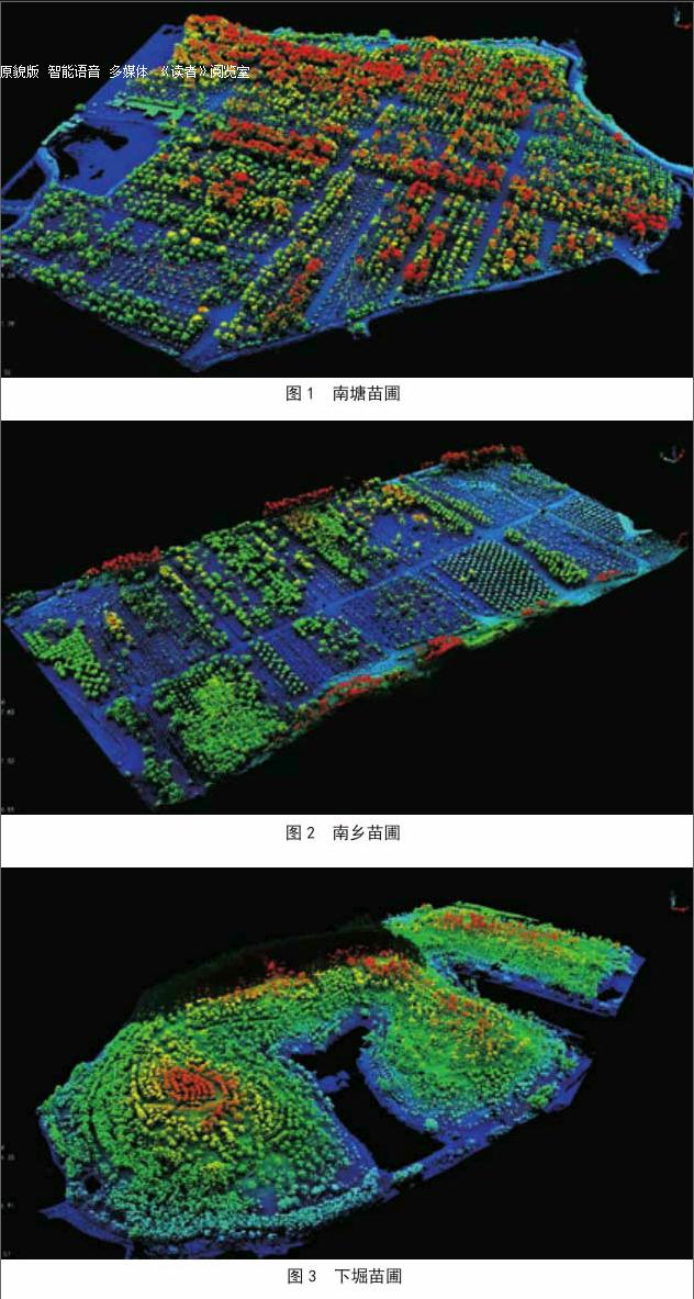

摘要:苗木是园林绿化建设的核心物质基础,园林苗圃的建设管理水平直接影响着园林绿化的建设和发展。为探索园林苗圃监测和管理的新手段,提高园林苗圃的信息化管理水平,采用无人机载激光雷达遥感技术,对广东省四会市的南塘、南乡和下堀3个苗圃苗木进行低空遥感测量,提取各个苗圃的分布、范围以及每株树木的坐标、树高、冠幅等信息,结果表明无人机激光遥感的方式能更加直观清晰、高效率地完成每木调查数据采集,实现苗圃的信息化管理。
关键词:无人机遥感技术;智慧苗圃;数据采集
中图分类号:TU986
文献标志码:A
文章编号:1671-2641(2017)03-0078-04
收稿日期:2017-04-11
修回日期:2017-05-17
Abstract: Seedlings constitute the core material basis of landscaping.The construction level of garden nursery may directly affect the development and construction of landscaping. This study adopts a method of low altitude scanning by unmanned aerial vehicle with laser radar to manually measure single seedling. We take aerial photos of three nurseries (Nantang, Nanxiang and Xiaku in Sihui City) and extract information including distribution, scope and coordinates, height and crown size of earch tree. The results show that the aerial photos taken from unmanned aerial vehicle would be more intuitive and efficient to complete survey data collection and realize nursery information management.
Key words: Unmanned aerial vehicle (UAV) remote sensing; Wisdom nursery; Data acquisition
引言
苗木是園林绿化建设的物质基础,园林苗圃是繁殖和培育苗木的基地,是供应城市绿化用苗的后勤部[1]。我国苗圃的经营管理存在管理体制、国家投入、人才等诸多方面不完善的问题,同时信息化建设还相对薄弱,造成苗圃的大面亏损[2]。按照国家信息化建设的推进和林业改革发展战略,采用新技术推进我国苗圃的管理水平和建设水平显得日益重要。
无人机遥感技术,是可应用于多领域的新信息技术。从数据获取、数据处理、与实测数据对比、分析试验数据误差、寻找试验误差原因的全过程来看,无人机在林业调查中的应用可行性高[3],樊江川对无人机航空摄影测树技术进行研究,结果表明通过无人机航空摄影测树木的主要特征……
登录APP查看全文
猜你喜欢
现代电子技术(2016年22期)2016-12-26 12:36:15
电子技术与软件工程(2016年22期)2016-12-26 11:11:30
现代电子技术(2016年22期)2016-12-26 09:44:35
电子技术与软件工程(2016年19期)2016-12-19 19:59:14
电脑知识与技术(2016年27期)2016-12-15 20:42:01
农业与技术(2016年15期)2016-11-09 17:43:03
科技视界(2016年18期)2016-11-03 22:51:40
中国科技博览(2016年22期)2016-11-01 16:58:26
软件工程(2016年8期)2016-10-25 15:54:18
软件工程(2016年8期)2016-10-25 15:52:53
