
基于GIS的区域环境风险综合评价
2019-08-06 00:39:36于露车前进
环境与发展
2019年6期
于露 车前进
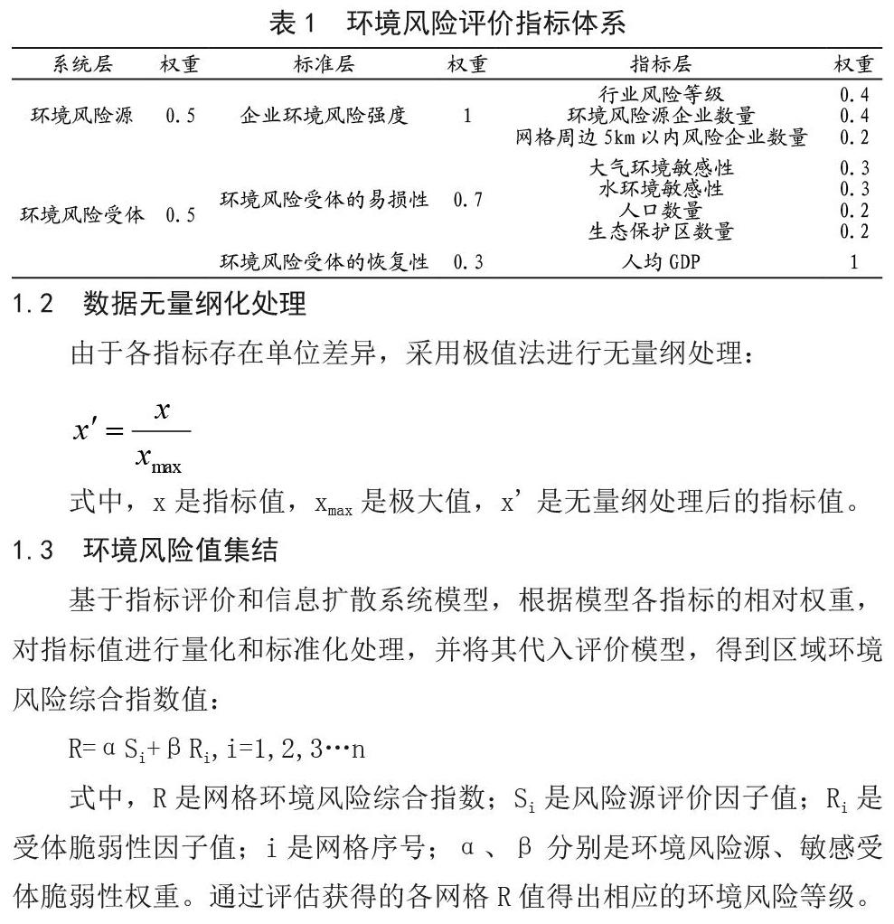
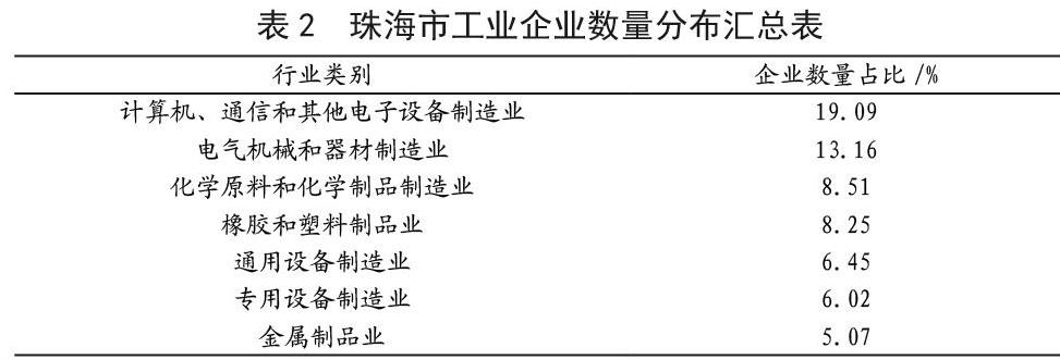
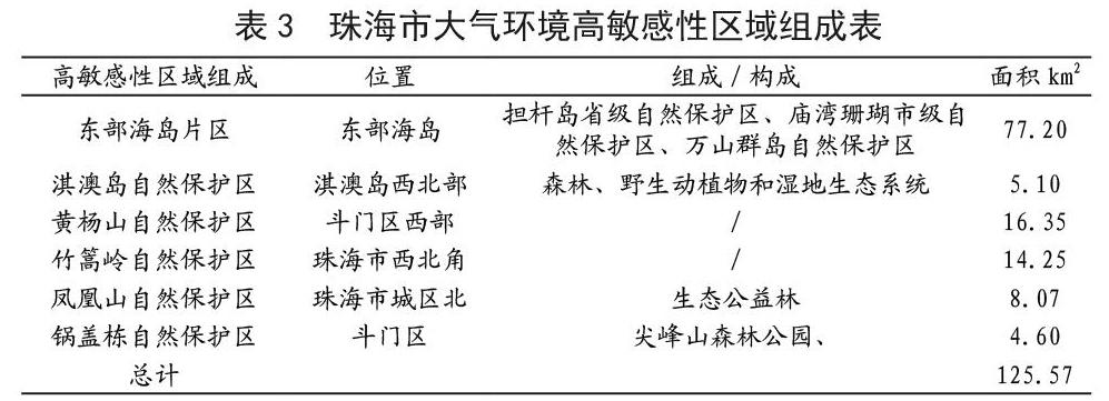
摘要:现阶段我国多数城市面临着结构性、布局性环境风险凸显的问题,导致行政区域突发环境事件发生频次高、影响范围广。以珠海市为例,基于地市级行政区域环境风险系统研究,构建评估指标体系,利用GIS技术确定基于空间地理网格的评估单元,在此基础上提出风险等级划分模型,对评估单元进行风险量化分级,并通过行政区域风险等级分区,掌握全域环境风险分级特征。
关键词:行政区域;环境风险评估;珠海市
中图分类号:X820.4 文献标识码:A 文章编号:2095-672X(2019)06-000-03
DOI:10.16647/j.cnki.cn15-1369/X.2019.06.004
Abstract: Most cities in China are confronted with strong environmental risks due to the issues related to their layout and industrial structures which lead to highly frequent environmental accidents in administrative regions with broad impacts. Taking Zhuhai city as an example, environmental risk analysis system research and environmental events based on the mechanism, set up the evaluation index system of municipal administrative regional environmental risk assessment, determining unit space based on the geographic grid using GIS technology, risk classification, risk characterization technology, proposed the risk classification model, application of regional environmental risk assessment methods can be divided into from high to low level of risk.
Keywords: Administrative region; Environmental risk assessment; Zhuhai City
近年来,随着中国工业化和城市化进程加快,环境问题日益突出,突发性环境事件频发,造成的社会危害与环境影响也显著增加[1-2]。环境风险管理得到越来越多的重视。根据《突发环境事件应急管理办法》要求,县级以上地方环境保护主管部门应当按照本级人民政府的统一要求,对本行政区域突发环境事件开展风险评估,分析可能的突发环境事件,提升区域环境风险防范能力[3]。目前,适应中国国情的区域环境风险评估理论及方法研究尚处于起步和发展阶段,尚未形成统一完善的区域环境风险评价方法及指标体系构建,这极不符合我国快速增长的区域开发活动,难以满足具有多样性及不确定性特征的区域环境风险评价的实际要求[4]。
国内外学者在区域环境风险防范、环境绩效研究等方面做了大量工作[5-9]。研究人员通过构建风险指标体系、计算风险指数值和建立风险分区图来进行区域环境风险评估[10-14]。……
登录APP查看全文
