基于GF卫星解译巴丹吉林沙漠湖泊水量变化
2020-10-12 14:30:30曹乐聂振龙姜高磊
人民黄河
2020年7期
曹乐 聂振龙 姜高磊
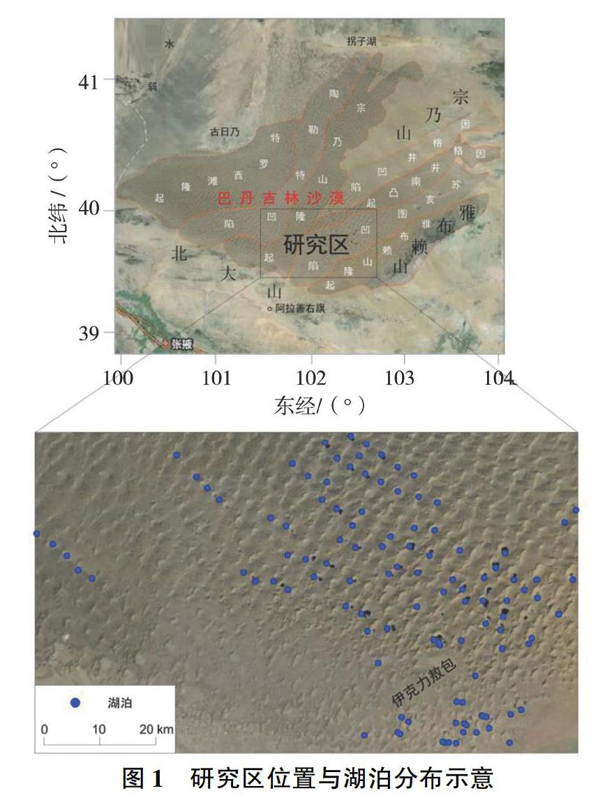
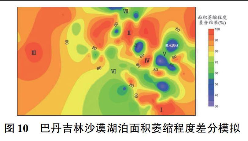
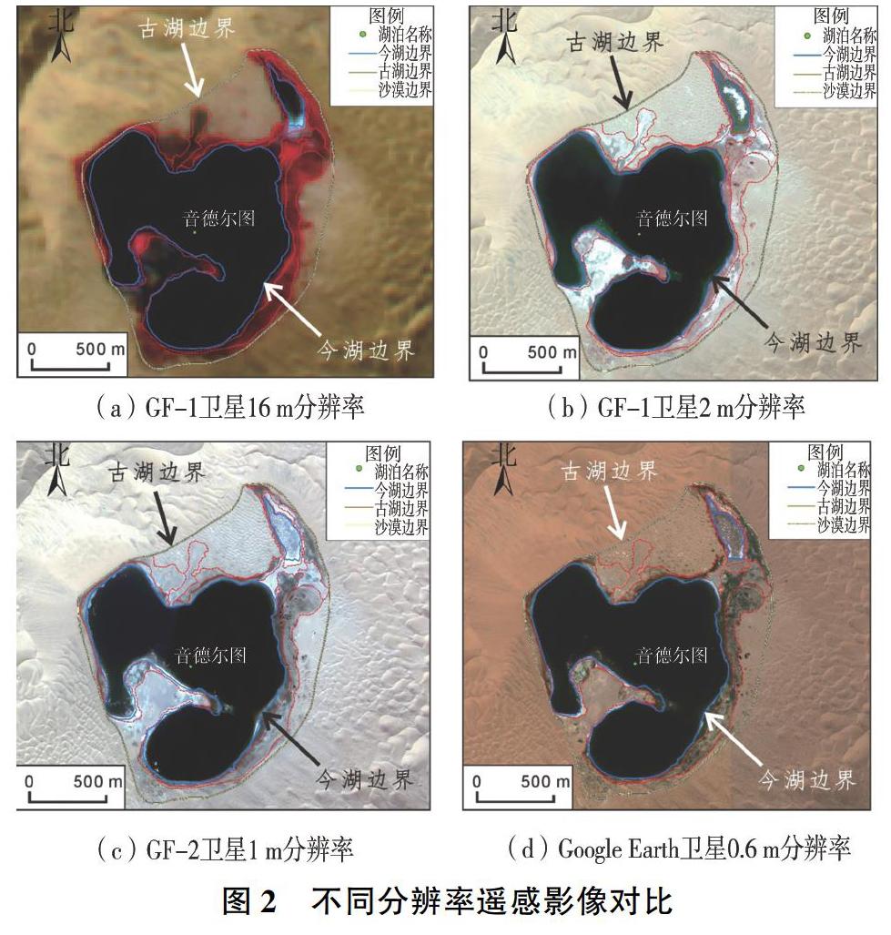
摘 要:遥感技术作为科学、快速、大面积调查监测手段,在湖泊演化、动态变化研究中应用广泛。通过解译国产GF-1、GF-2卫星遥感影像信息,结合实地勘测,解译了巴丹吉林沙漠110个湖泊地质历史时期与现代的湖面高程和边界,总结了湖泊萎缩规律,估算了两期水量变化。结果显示:湖面高程平均降低9.76 m,面积共减少61.052 km2(占古湖总面积的75.49%),湖泊群水量共减少4.9亿m3,说明湖泊萎缩程度高,沙漠干旱化趋势明显;研究区古、今地下水等水位线均表现出东南高、西北低的宏观特征,反映了古、今沙漠区地下水相同的补给来源与径流条件;基底凹陷区湖泊萎缩程度较低(如苏木吉林湖),基底隆起区湖泊萎缩程度较高(如雅布赖山前湖泊),萎缩程度的差异性受区域构造基底的控制与影响。
关键词:遥感解译;古湖高程;湖泊萎缩;水量变化;巴丹吉林沙漠
中图分类号:TV213.3 文献标志码:A
doi:10.3969/j.issn.1000-1379.2020.07.009
Abstract:Remote sensing technology is widely used in the study of lake evolution and dynamic changes as a scientific, rapid and large-scale investigation and monitoring method. This study obtained the elevations and boundaries of 110 lakes in ancient and modern in the Badain Jaran Desert, based on the GF-1 and GF-2 satellite remote sensing images and regional survey. The results show that the average lakes elevation is decreased by 9.76 m and the area of lakes reduced totally 61.052 km2, which accounts for 75.49% of the ancient lakes area. The total water volume of lakes has been reduced 490 million m3, showing high degree of shrinkage of lakes and obvious drought trend. The counter lines of groundwater have the characters of higher in southeast and lower in northwest generally whether in ancient or at present and those demonstrate the source of groundwater recharge and the groundwater runoff condition remains unchanged. The lakes shrinking are obviously in the basement uplift areas (e.g. Yabulai piedmont), while lightly in the basement depression areas (e.g. Lake Sumu Jaran). The differences of lakes shrinkage are controlled by the regional tectonic basement.
Key words: remote sensing interpretation; ancient lakes elevation; lakes shrinking; status change; Badain Jaran Desert
巴丹吉林沙漠位于阿拉善高原西部,面积4.9万km2,沙漠中有高大沙山以及100多个湖泊,为世界罕见[1-3]。关于湖泊成因、演变、补给来源等问题一直是第四纪地质与水文地质界研究的热点,但尚无定论[4-13]。遥感技术能够全方位、大区域地进行湖泊季节性、年际动态变化监测,是湖泊研究的重要技术手段[14]。朱金峰等[15]利用ETM+遥感影像,提取了湖泊年内季节变化信息,认为湖泊面积和数量在年内随季节依次减少,到第二年春季又恢复到前一年春季状态。张振瑜等[16-17]利用Landsat影像分析了1973—2010年湖泊的时空变化特征,认为地下水補给源水量变化和补给方式的不同控制着湖泊面积的时空变化。……
登录APP查看全文