
基于三维激光扫描技术在滑坡变形监测中的应用
2021-04-27 21:30:17孔文琼张瑜都赵瑞英
粘接
2021年7期
孔文琼 张瑜都 赵瑞英

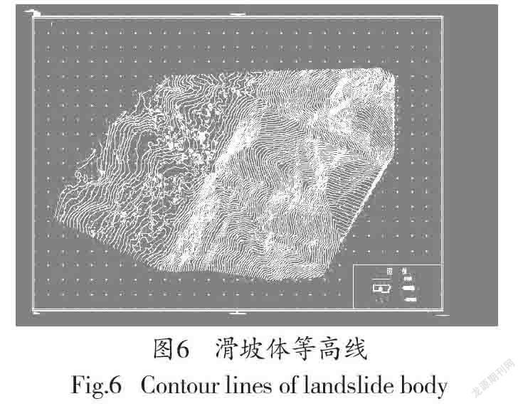
摘 要:以兰州某滑坡体为例,运用中海达HS1200三维激光扫描仪进行滑坡体数据采集、处理,与同期全站仪测得数据进行比较,并进行点位误差分析,建立了数字高程模型(DEM),生成等高线,利用相应软件HD 3L SENE计算滑坡体的体积。结果表明,两种方法变形量基本相同,三维激光扫描技术效率高,无需接触被测物体,点位误差为9.92mm,体积误差为0.45%,满足监测精度要求,对滑坡体采用三维激光扫描技术进行变形监测具有可行性。
关键词:三维激光扫描;滑坡变形监测;点云数据;对比分析
中图分类号:P642.22 文献标识码:A 文章编号:1001-5922(2021)07-0097-04
Application of 3D Laser Scanning Technology in Landslide Deformation Monitoring
Kong Wenqiong1, Zhang Yudou1, Zhao Riuying2
(1.Shaanxi Railway Institute, Weinan 714000, China; 2. China Railway Lanzhou Bureau Co., Ltd.,
Lanzhou 730000, China)
Abstract:This paper takes a landslide in Lanzhou as an example, Using the Haida HS1200 3D laser scanner to collect and process landslide data, coMPares with the data measured by the total station in the same period, and analyzes the point error. Establishes a digital elevation model (DEM), and generate contour lines. Calculate the volume of the landslide body with the corresponding software HD 3L SENE. The results prove that the deformation of the two methods is basically the same, the 3D laser scanning technology is highly efficient and does not need to touch the object to be measured. The point error is 9.92mm and the volume error is 0.45%. It can meet the monitoring accuracy requirements, and it is feasible to use 3D laser scanning technology for deformation monitoring of landslide body.
Key words:3D laser scanning; landslide deformation monitoring; point cloud data; coMParative analysis
中国是一个多山、地质灾害多发的国家,滑坡预报的技术手段之一是滑坡监测,传统的测量方法是利用全站仪、GPS等测量仪器进行观测,都属于单点监测,存在监测点较少、造价高、自动化程度低等问题[1]。三维激光扫描技术是近年出现的高新技术,又被称为“实景复制技术”[2],具有效率高、精度高、非接触性等优势[3],它可以获得滑坡体的三维坐标点云数据,从而能够详细的得到滑坡体细节和整体的变形信息。
1 三維激光扫描技术原理
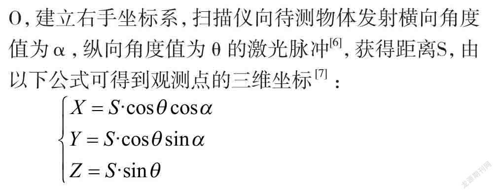
三维激光扫描是一种高速激光测距的测量技术[4],探测方法有多种,工程应用中一般都采用脉冲法进行测量,其原理是根据激光测距[5],以测站点为坐标原点O,建立右手坐标系,扫描仪向待测物体发射横向角度值为α,纵向角度值为θ的激光脉冲[6],获得距离S,由以下公式可得到观测点的三维坐标 [7]:
2 滑坡变……
登录APP查看全文
