蒙古冷涡影响下的豫东、豫南地区“七下八上”持续强对流天气背景场分析
2021-10-31 01:31:47王瑞祥
河南科技
2021年15期
王瑞祥
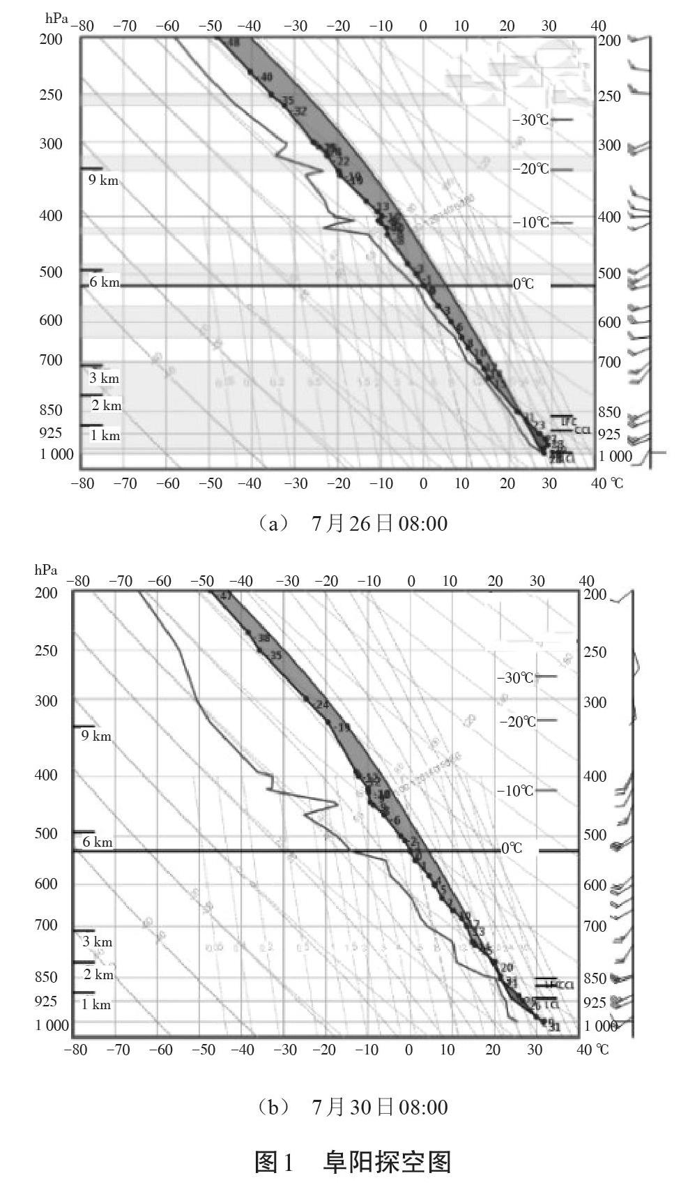
摘 要:本文利用常规观测资料、探空资料,对豫东、豫南地区2019年“七下八上”时期持续性强对流天气的时空分布特征及形成机制的背景场进行诊断分析。结果表明:7月下旬到8月初,西太平洋副高偏南偏弱,脊线位置维持在25°N以南,豫东、豫南处于副高西北侧西南暖湿气流中,蒙古冷涡强大且稳定地维持,持续分裂低涡东移并携带冷空气南下;中低空不断有气旋性切变、辐合中心形成;850 hPa在每日的08:00常形成西南急流,出口区位于豫东,豫南位于西南急流左侧。青藏高原夏季热源作用显著,形成温度脊指向华北地区。能量对流潜势良好,在中低层切变线触发机制作用下,配置以充足的水汽供应,产生了强烈的强对流天气。存在于200 hPa的高空急流,高空风将释放的凝结潜热带到下游,维持豫东、豫南上空的对流不稳定。
关键词:蒙古冷涡;强对流天气;水汽;热力
中图分类号:P429;P458文献标识码:A文章编号:1003-5168(2021)15-0135-03
Abstract: Using conventional observation data and radiosonde data, this paper diagnosed and analyzed the temporal and spatial distribution characteristics and background field of formation mechanism of persistent strong convective weather in eastern and southern Henan during the "seven down and eight up" period in 2019. The results show that from late July to early August, the western Pacific subtropical high is weaker southward, the ridgeline position is maintained south of 25°N, eastern Henan and southern Henan are in the southwestern warm and humid airflow northwest of the subtropical high, and the Mongolian cold vortex is strong and stable Maintenance, continued to split, the low vortex moved eastward and carried cold air southward; cyclones were sheared and convergent centers were formed at mid-low altitude; 850 hPa often formed a southwest jet at 08 o'clock every day, the exit zone was located in eastern Henan, and southern Henan was located in southwest Rapids on the left. The heat source of the Qinghai-Tibet Plateau is significant in summer, forming a temperature ridge pointing to the North China region. The potential of energy convection is good. Under the action of the low-level shear line trigger mechanism, it is configured with sufficient water vapor supply, resulting in strong strong convection weather. There is a high-altitude jet at 200hPa. The high-altitude wind will release the condensed latent tropical zone to the downstream and maintain the unstable convection over the eastern and southern Henan.
Keywords: Mongolian cold vortex;severe convective weather;steam;heat
强对流天气是河南省主要灾害性天气之一,常常给工农业生产、人民群众生活、航空、水运等带来不利影响。从相关标准可知,强对流天气是指出现直径≥5 mm的冰雹、或者龙卷风、或者≥17.2 m/s(或者8级)的雷暴大风、或者≥20 mm/h的短时强降水等天气。强对流天气具有时空分布不均匀、日变化大、局地性强、易致灾等特点,因此,一直以来是预报预警业务的难点和重点[1]。
近年来,多数学者都对强对流天气进行了深入研究,且取得了一定成效。郑媛媛等利用常规气象资料、自动站资料、卫星资料、NCEP再分析资料,对2001—2010年安徽省強对流天气过程的物理机制、中尺度特征进行分析[2]。……
登录APP查看全文