
东北地区一次暴雨天气过程诊断分析
2021-12-17 19:17:02易希延孙琳琳马湘宜
农业灾害研究
2021年8期
易希延 孙琳琳 马湘宜
摘要 本文利用风云卫星、高空及地面观测资料,分析2018年7月16—17日在东北地区出现的一次暴雨过程的天气特征。结果表明:(1)此次暴雨为经典的副高后部型暴雨,500 hPa高空槽与副高北部间强位势梯度导致低层低空急流加强并稳定维持,槽前正涡度平流导致的偏差风辐散使低层减压,配合低空急流中的切变涡度形成低空低涡,强降水主要出现在低涡的前侧、暖切变南侧;(2)200 hPa高空急流辐散区,地面中尺度低压和地面辐合线,配合地形辐合抬升作用为暴雨增幅提供有利条件;(3)模式降水预报偏小,可能与模式对副热带高压预报偏弱,以及850 hPa风场风速预报偏弱有较为密切的关系,同时模式对复杂地形的刻画能力不足,也是导致降水预报误差的原因。
关键词 暴雨;对流;多源观测;低空急流;低空低涡
中图分类号:P458 文献标识码:B 文章编号:2095–3305(2021)08–0047–02
Diagnosis and Analysis of a Heavy Rain Process in Northeast China
YI Xi-yan et al(Panjin Meteorological Bureau, Panjin, Liaoning 124010)
Abstract Using FY satellite, high-altitude and ground observation data to analyze the weather characteristics of a heavy rain process that occurred in the Northeast from July 16 to 17, 2018. The results show that: (1) This heavy rain is a classic rainstorm at the rear of the subtropical high. The strong geopotential gradient between the 500 hpa trough and the northern part of the subtropical high leads to the strengthening and stable maintenance of the low-level low-level jet, and the deviation wind caused by the positive vorticity advection in front of the trough. The divergence makes the lower layer decompress, and the shear vorticity in the low-level jet is an important mechanism for the formation of the low-level low vortex. Heavy precipitation mainly appears on the front side of the low vortex and the south side of the warm shear; (2) The 200 hPa high-altitude jet divergence area, the ground mesoscale low pressure and the ground convergence line, combined with the terrain convergence and uplift, provide favorable conditions for the increase of heavy rainfall; (3)And the weak wind speed forecast of the 850 hPa wind field has a close relationship. At the same time, the models insufficient ability to portray complex terrain is also the cause of precipitation forecast errors.
Key words Heavy rain; Convection; Multi-source observation; Low-level jet; Low-level vortex
我國受暴雨灾害影响较大,近年来对暴雨的研究也取得了一些成果[1-2]。本文旨在利用多种观测资料,分析2018年7月一次发生在东北地区的暴雨天气成因,结合多种物理量因子及其阈值,总结该类型天气发生的主要机理,为今后暴雨预报提供科学的依据。
1 降雨实况及资料方法
2018年7月16—17日,受低涡暖切变和副热带高压共同影响,东北地区北部出现明显降水。其中,暴雨区位于黑龙江西南和中南部地区,暴雨区范围较小。
2 天气尺度系统及物理量
2.1 高空及地面形势场
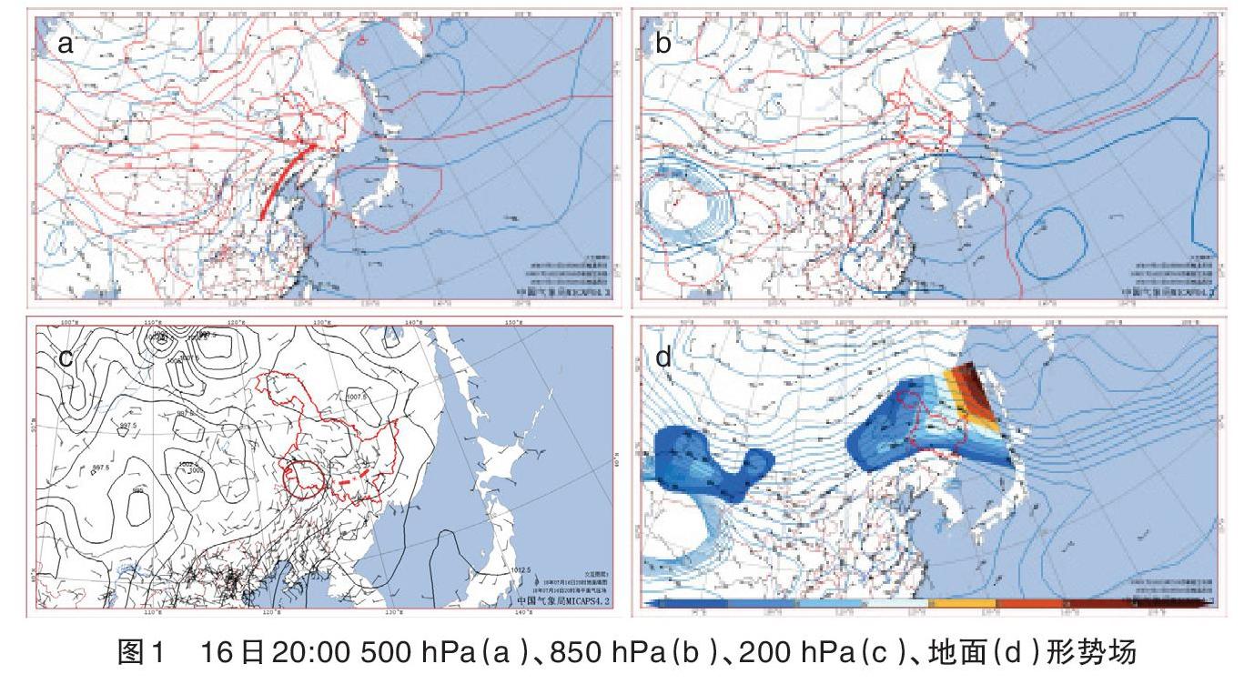
16日20:00,500 hPa副高西伸北抬,且维持稳定,北部脊线位于40°N以北,黑龙江长时间处于副高北部的暖湿环境中。……
登录APP查看全文
