
基于LiDAR数据不同插值算法DEM构建研究
2019-06-07 07:22:54尤号田邢艳秋丁建华
森林工程
2019年3期
尤号田 邢艳秋 丁建华
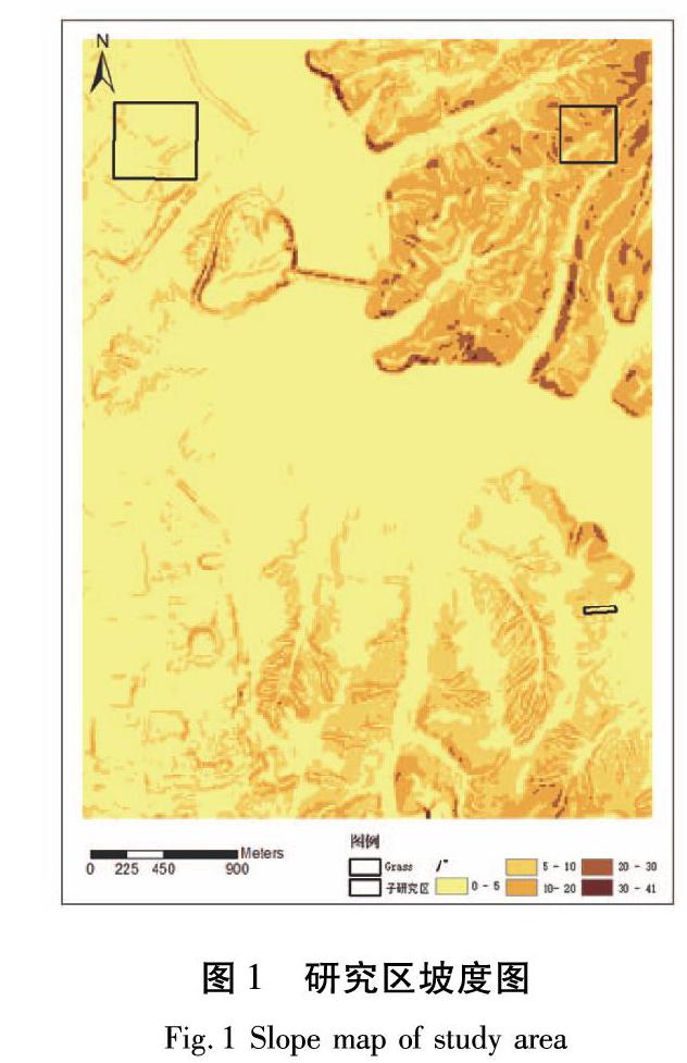
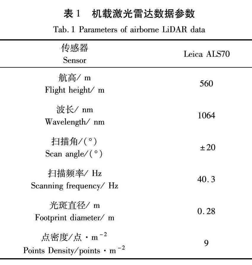

摘要:数字高程模型(DEM)是进行多种空间应用的基础,通常由地形三维坐标数据经内插得到,由于受插值算法性能的影响,因此本文对不同插值算法DEM生成结果进行对比研究。本研究以机载激光雷达数据为基础,基于常用插值算法,如:反距离加权插值算法、克里金插值算法、自然邻域插值算法和样条插值算法,生成城区、草地和林地3种不同地物类型DEM插值结果,并对所得插值结果进行对比研究。结果对于城区和草地较平坦区域而言,自然邻域插值算法结果较好,RMSE分别为0.433 m和0.052 m;而对于地形起伏较大的林地而言,样条插值结果较优,RMSE为0.748 m。结果表明,地形平坦区域DEM插值结果优于地形起伏较大区域,且不同插值算法在不同地物类型表现不同。
关键词:数字高程模型,激光雷达数据,插值算法,林地
中图分类号:TP79文獻标识码:A文章编号:1006-8023(2019)03-0020-06
Research on DEM Construction with Different Interpolation
Algorithms Based on LiDAR Data
YOU Haotian1, XING Yanqiu2*, DING Jianhua2
(1.College of Geomatics and Geoinformation, Guilin University of Technology, Guilin 541004;
2.Center for Forest Operations and Environment, Northeast Forestry University, Harbin 150040)
Abstract:Digital elevation model (DEM) is the foundation of many spatial applications and usually obtained by interpolation of terrains three-dimensional coordinates. And the accuracy of DEM is affected by the interpolation algorithm. Therefore, it is necessary to study the performance of different interpolation algorithms. In this paper, the commonly used interpolation methods, namely, inverse distance weighted interpolation, kriging interpolation, natural neighborhood interpolation and spline interpolation, were used to construction DEM based on airborne LiDAR data. And the results of different interpolation methods under urban, grassland and forest land use types were compared. It was showed that the results of natural neighborhood interpolation algorithm were better and RMSEs were 0.433 m and 0.052 m for the flat area of urban and grassland, respectively. While for the forest land with large terrain fluctuation, the result of spline interpolation method was better and the RMSE was 0.748 m. It was concluded that the results of DEM interpolation in flat terrain area were better than those in large terrain fluctuation area, and different interpolation algorithms had different performances under different terrain types.
Keywords:Digital elevation model; LiDAR data; interpolation algorithms; forest land
0引言
地球表面在调节全球气候、大气、水文以及生态过程方面均起着重要作用,对地球表面特征的准确描述能够帮助人类更好的理解上述过程[1],而地球表面特征最简单有效的量化方法之一是应用数字高程模型(Digital Elevation Model,DEM)[2]。DEM是用于存储地形信息的通用数据结构,通常由离散数据点经内插得到,并通过分析获得区域的地形特征。
传统DEM创建方法需要进行野外实地测量,因而导致DEM生成成本较高且耗时费力[3-4]。随着技术的发展,摄影测量已成为生成DEM的主要方法之一[5]。近年来,光探测测距(Light Detection and Ranging,LiDAR)系统凭借其能高精度、实时和大面积高效地采集三维信息的优势,现已成功用于数字城市、海岸监测和森林资源清查等领域[6-9],并发展成为地形数据采集的有效方法[10]。……
登录APP查看全文
