
基于加权TOPSIS模型和GIS技术的耕地提质改造潜力及区域分布研究
2021-01-05 20:57:31靳乐乐
安徽农业科学
2021年24期

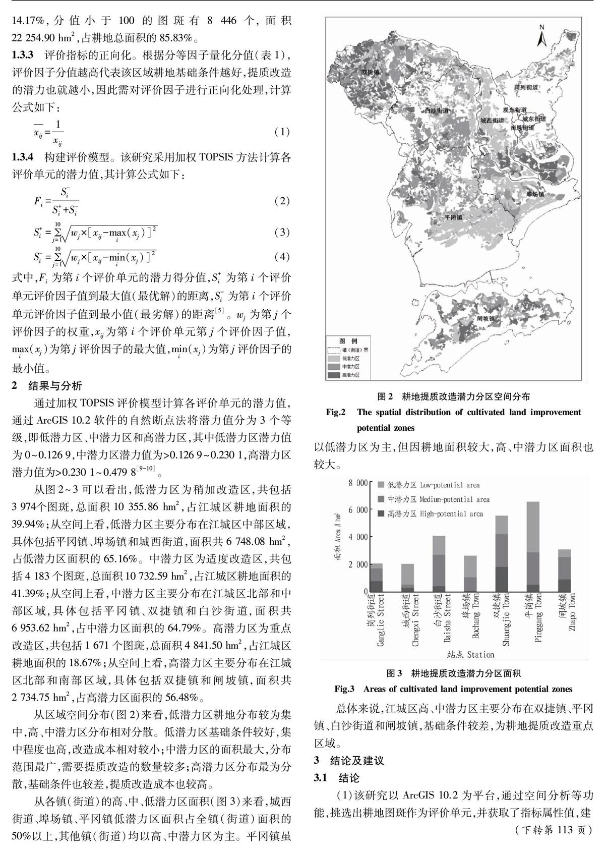
摘要 以阳江市江城区为研究区,从地形地貌、土壤基本性状、土壤管理等方面选取10个评价因子,通过加权TOPSIS模型和ArcGIS软件的空间分析功能对研究区的耕地提质改造潜力进行测算,并利用自然断点法对潜力进行分级。结果表明,高、中、低3个潜力区域面积占比分别为18.67%、41.39%和39.94%,高、中潜力区主要分布在双捷镇、平冈镇、白沙街道和闸坡镇。这为江城区合理安排耕地提质改造区域和建设时序提供了基础数据。
关键词 耕地提质改造;加权TOPSIS模型;GIS技术;区域分布;自然断点法;潜力
中图分类号 F323.211 文献标识码 A
文章编号 0517-6611(2021)24-0106-03
doi:10.3969/j.issn.0517-6611.2021.24.024
Research on the Potential and Regional Distribution of Cultivated Land Quality Improvement Based on Weighted TOPSIS Model and GIS Technology
JIN Le-le (Guangdong Institute of Geological Surveying and Mapping, Guangzhou, Guangdong 510800)
Abstract Taking Jiangcheng District of Yangjiang City as the research area, this paper selected 10 evaluation factors from the aspects of topography, basic soil properties and soil management, calculated the potential of land quality improvement and transformation in the study area through the weighted TOPSIS evaluation model and the spatial analysis function of ArcGIS software, and classified the potential by using the natural break point method. The results showed that the area ratio of high, medium and low potential areas were 18.67%,41.39% and 39.94% respectively, the high and medium potential areas were mainly distributed in Shuangjie Town, Pinggang Town, Baisha Street and Zhapo Town. This provides basic data for the reasonable arrangement of reconstruction area and construction sequence of land quality improvement in Jiangcheng District.
Key words Land quality improvement;Weighted TOPSIS model;GIS technology;Regional distribution;Natural break point method;Potential
作者簡介
靳乐乐(1987—),男,河南汝阳人,工程师,硕士,从事国土空间规划、生态修复研究。
收稿日期 2021-06-22
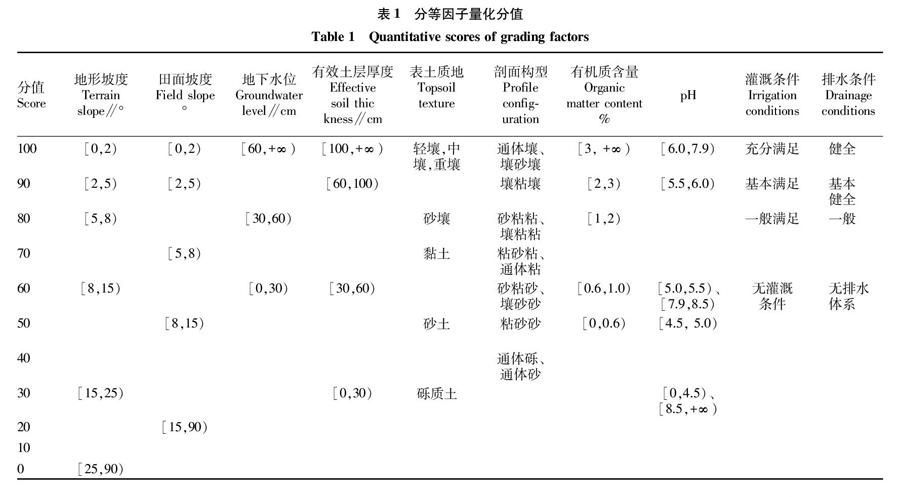
耕地是我国重要的战略资源,耕地质量的好坏影响着我国的粮食产量。为提高耕地质量,增加粮食产量,在“十二五”以来,我国开展了高标准农田建设、土地复垦等土地整治活动。广东省地少人多,无法避让耕地的建设项目较多,且耕地存在碎片化、水利设施不足、质量较低、农业环境恶化等情况,因此亟需通过耕地提质改造来提升耕地质量,落实耕地占补平衡,维护国家粮食安全。笔者以阳江市江城区为研究区,结合该研究区2018年土地变更调查数据库中的耕地图斑和2018年耕地质量等级评价中地形地貌、土壤基本性状、土壤管理等评价因素[1],通过加权TOPSIS评价模型和GIS技术,分析研究区内耕地提质改造的潜力,并依据潜力值划分出耕地提质改造潜力分级区,为江城区开展耕地提质改造选址工作提供一定的指导。……
登录APP查看全文
